
by Capt. Richard Brennan, NOAA
Your father’s nautical chart is no longer good enough. The size of the ships navigating today’s waterways has rendered them obsolete. The reduced clearances below the keel, above the mast, and laterally within the channel have forced the mariner to demand new tools to safely accomplish their passage from sea to berth efficiently and with statistical confidence. NOAA is responding to this pressing problem by developing a new generation of products and services to support the mariner’s need for precision navigation. These new products and services will enable 24x7 port operations, increase the effectiveness of both passage planning and execution, and allow easy access to NOAA’s navigational data in formats that support predictive analysis of under-keel clearances that help manage transit risks.
Your father’s nautical chart is no longer good enough. The size of the ships navigating today’s waterways has rendered them obsolete. The reduced clearances below the keel, above the mast, and laterally within the channel have forced the mariner to demand new tools to safely accomplish their passage from sea to berth efficiently and with statistical confidence. NOAA is responding to this pressing problem by developing a new generation of products and services to support the mariner’s need for precision navigation. These new products and services will enable 24x7 port operations, increase the effectiveness of both passage planning and execution, and allow easy access to NOAA’s navigational data in formats that support predictive analysis of under-keel clearances that help manage transit risks.
NOAA’s e-navigation role is to provide accurate and timely
coastal intelligence to the maritime community and to deliver that information
in a direct and visually stimulating method to the location where port
operators and mariners make decisions. Asking maritime professionals to
bookmark data sites here and there, and to carry multiple data delivery systems,
is simply not sustainable. The next generation of navigational tools in an
electronic environment needs to be integrated (or, at the very least,
“integrate-able”) and intuitive.
So what is NOAA actually doing to get from your dad’s chart
to the next generation of navigation systems?
In developing the suite of next generation navigation
services, NOAA first looks to what the mariner is trying to accomplish: 1)
reduce the risk of collisions, allisions, groundings and oil spills; 2) maximize
cargo volume; 3) reduce shipping delays; and 4) minimize port congestion.
 |
|
Figure 1: The
Precision Navigation Tool developed by NOAA was designed to demonstrate the
power of coupling high resolution bathymetry with real-time water levels
(tides) to dynamically portray areas where it is safe to navigate (green) based
on a particular vessels draft, and where the water is too shallow (red). View this prototype at http://pnt.nauticalcharts.noaa.gov/LALB/
|
In a new prototype program, NOAA now provides data feeds for a navigational information system where
the whole is greater than the sum of the parts (Figure 1). To begin with, the
agency has a powerful trove of data, including both real-time measurements and
modelled forecasts for water levels, wind, waves, currents, and water salinity.
When these are coupled with high-resolution bathymetry (complete coverage depth
information) and supported by a high-accuracy geodetic framework, these data can
provide a simple service that informs the mariner about the statistical
probability of grounding. This is further refined by the anticipated ship’s
motion given the wind and wave direction, the known motion characteristics of
their ship, anticipated crab angles, and the required headings needed to
achieve a required “course made good” with the current meteorological
conditions.
Jacobsen Pilots, in collaboration with Charta Software, is
currently testing and evaluating this new suite of NOAA’s prototype products ‒ high-resolution
bathymetric charts, wave models, and real-time water levels ‒ in the Port of
Long Beach. They are specifically evaluating the products for integration with a
new under-keel clearance management system. NOAA has also provided high-resolution
chart cells in the Inland Electronic Navigational Chart IENC product format (for
the Ports of Los Angeles and Long Beach) to software developers to test and
analyze in their chart plotter and portable pilot unit systems (see at: nauticalcharts.noaa.gov/mcd/enc_overlays.html). These IENC cells are used because they offer
the flexibility to display higher density soundings and contours to the
mariner. Even higher resolution gridded
bathymetric data is available for interested software developers.
NOAA will carry the lessons learned in Long Beach and Los
Angeles to other ports across the country. In the next three years, the agency
will work with maritime stakeholders in the highest volume ports across the
country including the ports of the southern Mississippi, Houston-Galveston, and
New York.
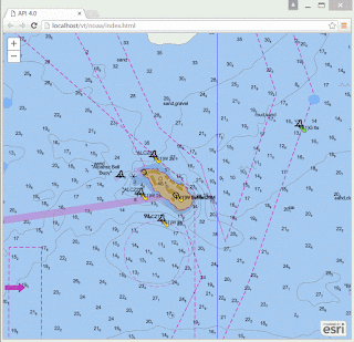

Figure 2: This animated GIF demonstrates the power of vector tiles to seamlessly zoom, pan, and rotate nautical chart data and provide an increasing amount of data resolution as the user zooms in. Image provided compliments of ESRI.
Looking a bit further out to the future, NOAA is developing
new electronic chart formats that will carry even higher resolution data. The
GIS industry is also developing new vector formats that are compact and easily
transmitted, which will optimize the scale and content of navigation-related data
used via existing cellular networks to 3G and LTE enabled mobile devices.
Web-based “tiled” maps, inspired by video game technology, make it possible for
mobile devices with personal GPS navigation to deliver maps with zoom and pan
features (Figure 2). As these maps have begun to shift from raster images like
paper charts to vector images like IENC, the underlying technologies have been enabled
by the Open Source community adoption for products like OpenStreetMap. The
recent open specification for vector tiles (https://github.com/mapbox/vector-tile-spec)
will eventually enable all modes of use to have access to vector information in
the same way we now use the raster images. This will create great opportunities
for fit-for-purpose navigation information services with optimized cartography
beyond anything your father could imagine in yesterday’s wheelhouse.
The next generation of navigational system products will be
a boon to the maritime industry ‒ but it goes further than that. The nation will benefit from
ports that are more competitive, port communities that are more resilient, and vessels
that produce fewer emissions thanks to decreased idling time and optimized
speed during their approach. So, the question isn't whether the nation needs
next generation navigational system products. The important question is: how
soon can we deliver them?
Copyright © Philips Publishing Group 2016
Copyright © Philips Publishing Group 2016
No comments:
Post a Comment